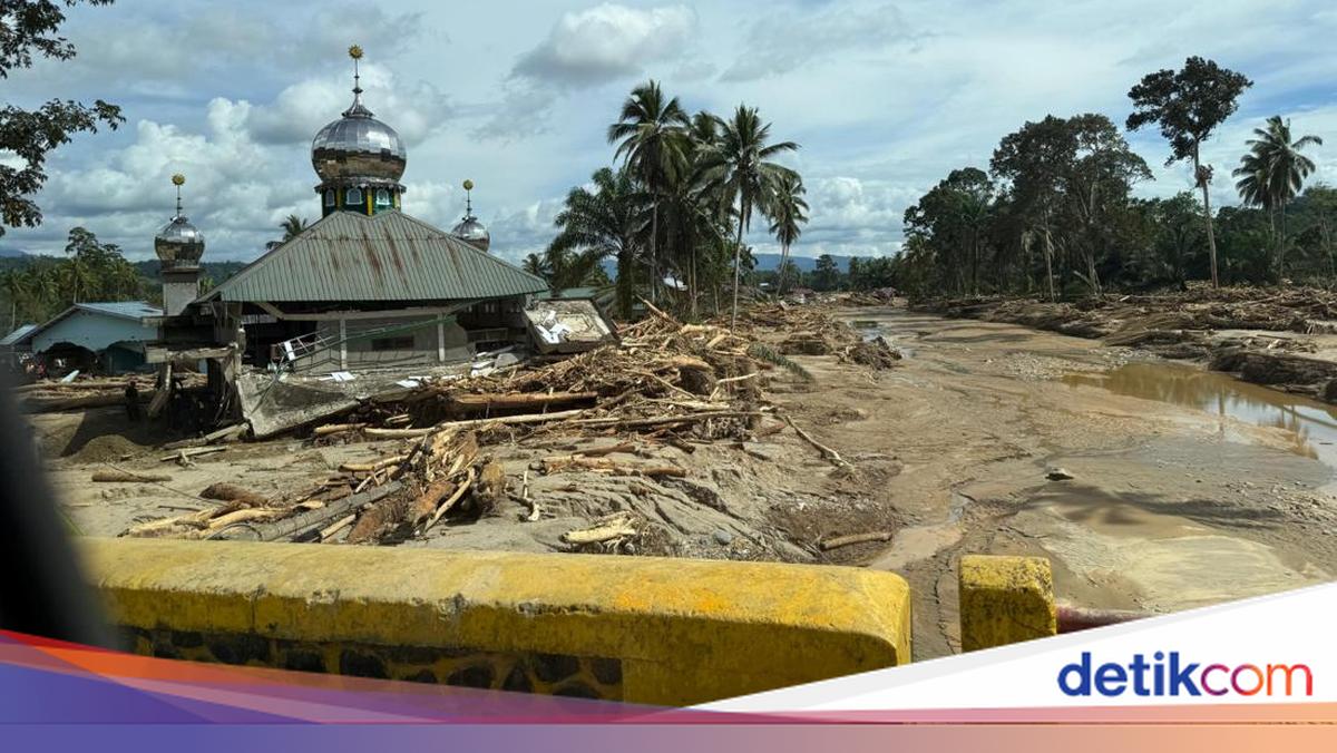
Jakarta – Minister of Environment Hanif Faisol Nurofiq explained the causes of the extreme floods that hit the Sumatra region. The disaster occurred as a result of high rainfall that was exacerbated by landscape conditions and changes in spatial planning. Hanif gave an example of what happened in the Batang Toru area, South Tapanuli. He said the area did not experience heavy rain, but still suffered serious damage. “Why does Batang Toru have such a big impact on damage? Because the landscape is shaped like a V. So Central and South Tapanuli are on slopes, in valleys. So when the right and left slopes are disturbed, quite a big disaster occurs. Even if the rainfall is extreme, it is not very extreme,” Hanif told journalists, at Hotel Indonesia2/Kempinski, Tuesday (20252, Kempinski). Scroll to continue content Hanif also explained the condition of Batang Toru when it rains. He said the lack of trees also affected flood conditions. “Well, as soon as it rains, it is certain that there will be no trees. There are 38 percent of the trees, but they are in the middle and downstream. So their resistance is not too great,” he said. Hanif then explained the factors that caused the disaster in Aceh. In monitoring carried out by the Ministry of Environment, Hanif said, rainfall in Aceh was more extreme than that which occurred in Batang Toru. “Then we talk about Aceh. Aceh, with a landscape of 3.3 million hectares, has more extreme rain than Batang Toru. So Aceh is recorded in some places that it even reaches 400 mm. This means that if it is 400 mm, 300 more, let’s say it is 330 multiplied by the area of 2.3 million days, which is then in two, 3.h days. 9.7 billion cubic meters of water arrived. Imagine that area water, who can survive? Meanwhile, about the disaster in West Sumatra, Hanif said it was caused by a combination of extreme rainfall and landscape conditions. “Well then in West Sumatra this (rainfall) is also extreme compared to Batang Toru. Then it has a rather short and steep landscape. So the victims are also relatively large,” he added. Hanif said that his party is currently conducting an in-depth investigation on this case. He also said that he has called related parties to investigate. “Well, these are the steps that we are currently studying. Because it appears that there has indeed been a dramatic change in our spatial layout. We collected detailed data and through satellite images we studied. We have also invited entities along the watershed to attend the Ministry of Environment so that we will immediately begin the investigation period related to this case,” he concluded. Also watch the video “The Minister of Environment Reveals the Cause of Batang Toru Tapsel Suffering Severe Damage” (ygs/ygs)